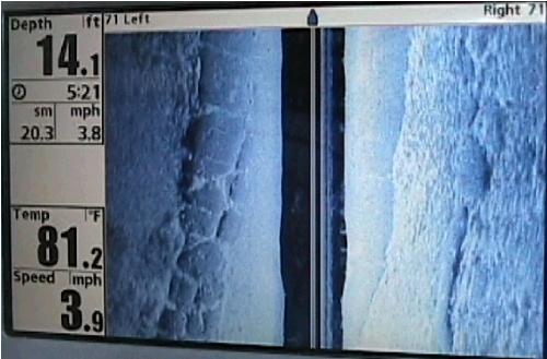
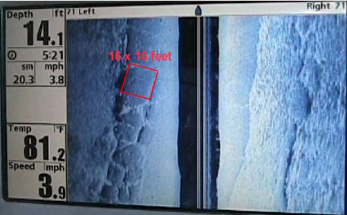
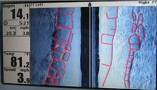
Below: Three images from the side-scan sonar of a portion of the Andros Platform. Top image is the raw image. The center of the image (vertical dark area) is the area directly under the boat. Each side of the image (to the left and right of the dark center line), shows the bottom covering an area totalling 142 feet wide and about 80 feet long. The second image shows how various forms on the bottom, such as stone, can be measured by the technology. The red outlined block is 16 x 16 feet. The bottom image shows all the blocks outlined, and actually captures portions of all three tiers of the formation. | ||
 | ||
 | ||
 | ||